Patch Notes: The Ogallala Aquifer
This week, we have something so interesting (and important), it took up the entirety of my writing attention. It also provides an unfortunately effective example of some core systemic principles in action, as we shall see in a moment.
Something Interesting: The Ogallala Aquifer
Beneath the North American Great Plains lies an entire sea of water -- about 3600 cubic kilometers of it, about the same size as Lake Huron. This vast hidden water-source is the reason the American high plains are as fertile as they are: it currently supplies 30% of all groundwater irrigation in the United States.
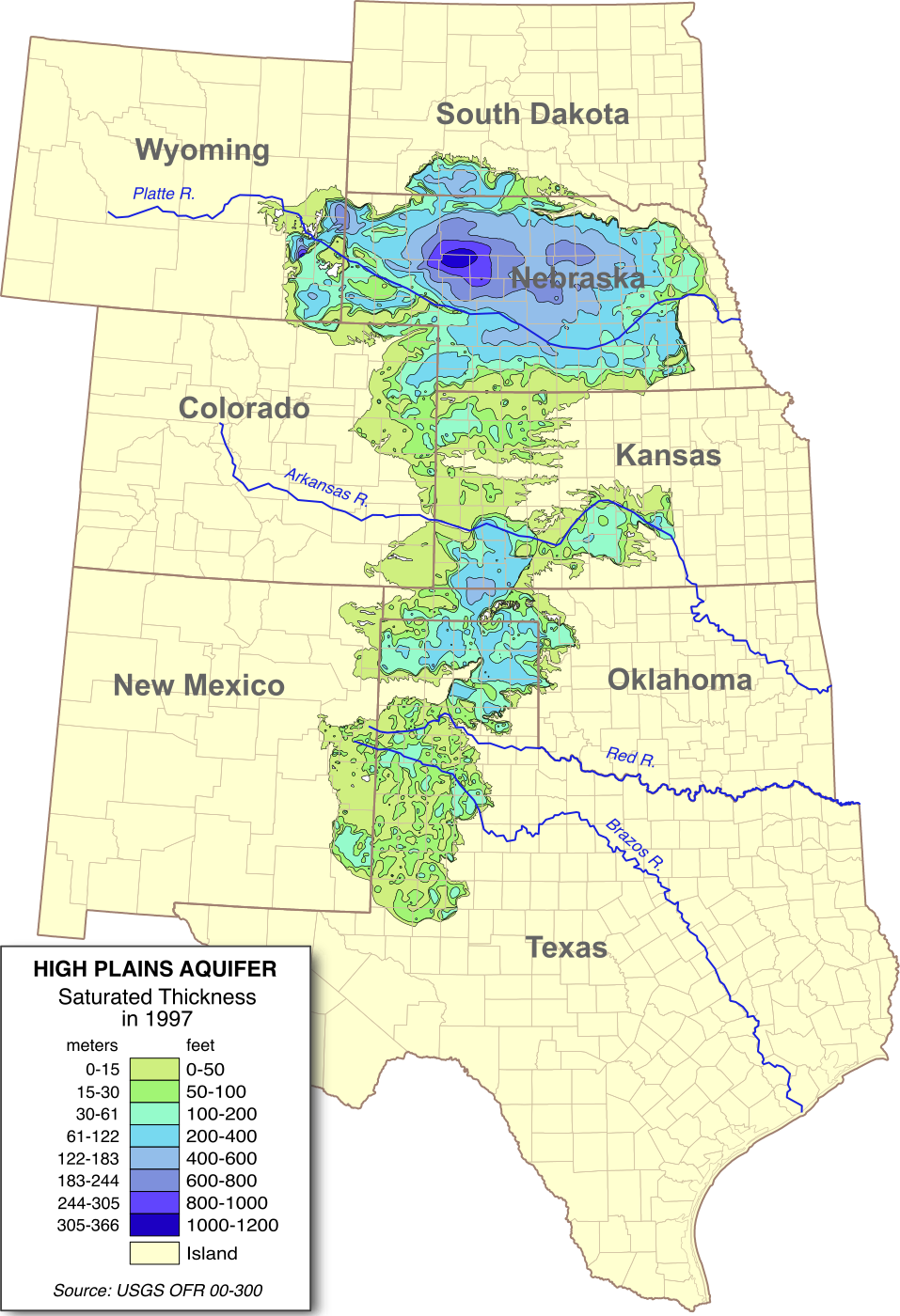
The Ogallala Aquifer is one of the largest aquifers in the world, and it did not get here by magic.
Its story begins seventy million years ago, in the slow tectonic cataclysm that was the Laramide orogeny. Continent-sized tectonic plates under the Pacific ocean were colliding into, and sliding under, the North American plate. In the north, that caused the edge of the plate to crinkle like a rug on a hardwood floor, rippling up into the sharp Canadian Rockies. Further south, something stranger (and still not quite understood) happened: the Farallon plate seems to have sliced under the skin of North America like a knife, leaving a flat plain across California and Nevada, and finally snagged at what was then the shore of a shallow sea that lapped at a beach where Denver now lies.
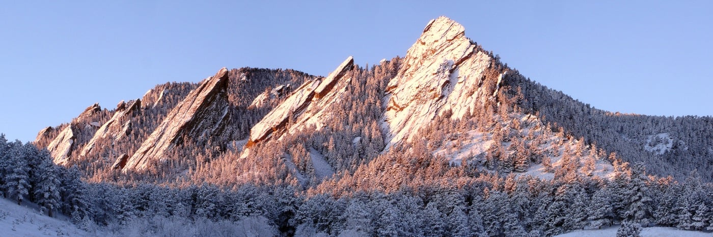
The pressure continued to drive into the back of that knife, and layer after layer of crust piled up. The seafloor folded up at the edge, forming the iconic Flatirons of Boulder (dinosaur footprints can still be found fossilized in some of these, as if whole herds of adults and young were walking straight up the side of a sheer cliff), and the highlands formed an alpine plateau over 15,000 feet above sea level.
Time passed. A mountain the size of Everest fell from the sky into the shallow waters off Mexico, bringing about a century of ash and darkness, and ending the lines of three-quarters of all existing animal species. When the sun finally emerged, it was on a new world of mammals and the few smaller surviving dinosaurs that were the ancestors of modern birds.
In the thousands of millennia that followed, the great high Rockies eroded, the coarse gravels and sands of their highlands being carried by new rivers downstream into the now-empty sea basins of the former world, filling them over the millennia that stretch between then and now.
Water filled this new looser material, saturating it down to the much denser layer of the ancient seabed. It caught and dammed, and filled from the top. Ice ages came and went in concentric frequencies and intensities, driven by the wobble in Earth's axis and the strange effects of Jupiter on our orbit (something interesting for another time), each period of glaciation and melting re-sculpting the surface of the new erosion-fed Great Plain.
In the last million and a half years, the cold intensified, and glaciers spread down from the arctic to cover most of what is now Canada, Russia, and Northern Europe. By 15,000 years ago (by which time humans had spread throughout Africa, Europe, Asia, Australia, and the Americas), those glaciers had reached well into the midwest, as far south as modern day Des Moines, Iowa.
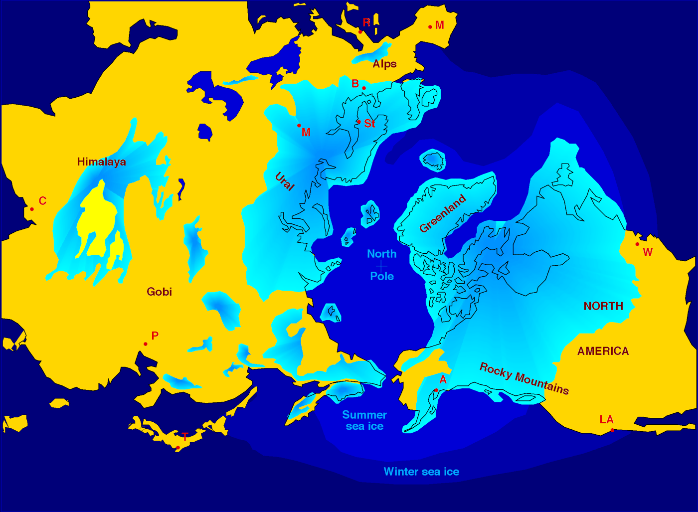
In the freezing, arid conditions at the foot of these glaciers, a vast cold desert formed, immense dunes of fine sand over a hundred meters in height. Fortunately for those of us who arrived much, much later, this just happened to occur right above the deepest sea valleys of that ancient ocean filled in with Rocky Mountain gravels and sands. That meant that water had over 360 meters (~1200 feet) of porous depth to fill, and a wide sandy desert overhead that caught the rain and glacial melt and drank it thirstily.
Even today, rainfall in western Nebraska sinks directly through the thin grasses, seeps through the vegetation-fixed dunes that are still there, and trickles back into the aquifer. This structure of sandy rain-sink and deep reservoir is the fullest part of the Ogallala aquifer, containing over two thirds of its entire volume. It is also by far the primary source of aquifer regeneration; the harder high plains of Texas and Oklahoma shed most of their water into arroyos that run down to the river system rather than sink them back into the earth. Without the sink of the Sandhills, the aquifer would empty faster than it fills (the Platte and other rivers on average drain more water from the Ogallala structure than they add to it); but even as it is, filling it to capacity takes about six thousand years.
And here we arrive at the rub. Since industrial wells for irrigation were first drilled into the aquifer in the 1950s, about 9% of its total volume has been consumed by agriculture (as well as some marginal use by industries like coal and oil extraction). And despite improving techniques for using water efficiently in farming, usage is accelerating: the amount of water lost between 2001 and 2008 was a full third of that lost in the entire twentieth century before it.
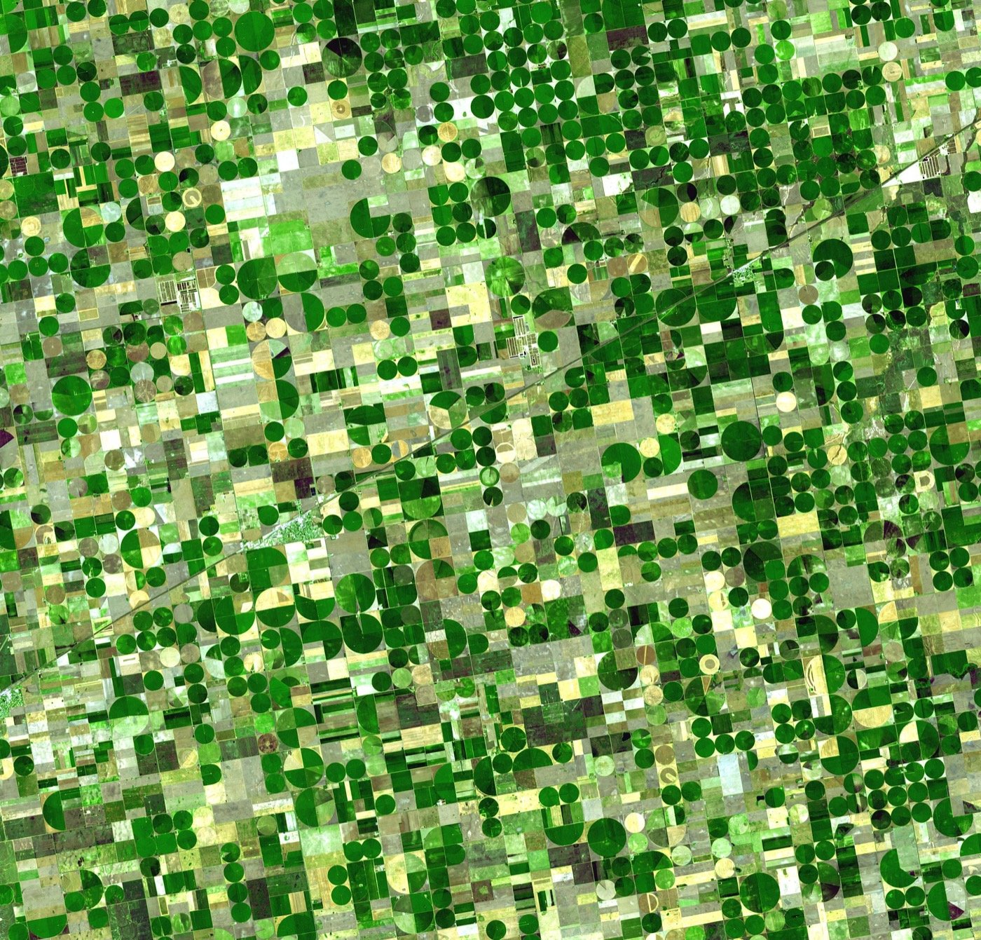
In addition, that beautiful Sandhills water-sink is a double-edged sword. Just as it efficiently collects rainwater, it also efficiently collects pollutants. Nitrates from industrial farming fertilizer have been ticking up steadily ever since measurements began, and while they are still under federally-defined "safe" levels, that won't be true forever.
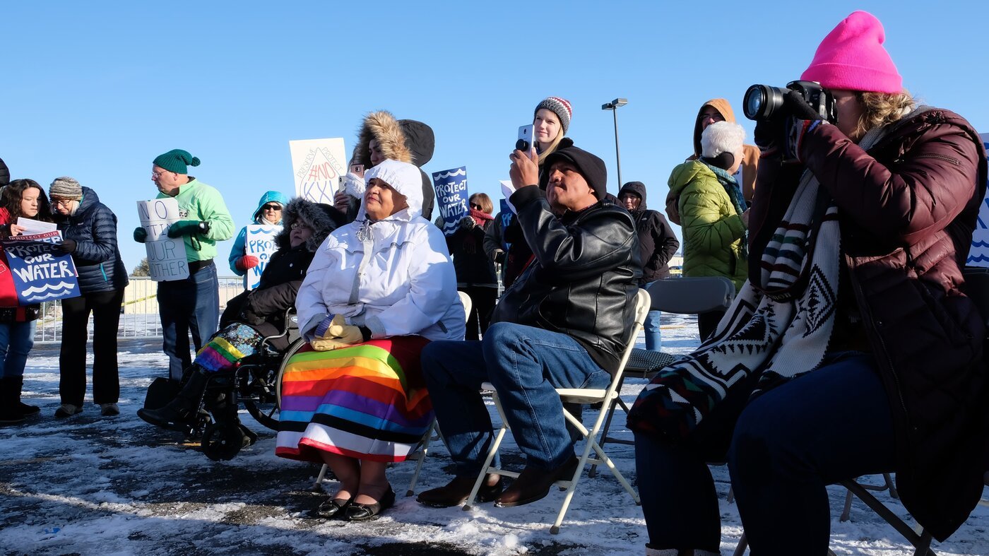
And that's just farming. Protests by Bold Nebraska and other locals against the Keystone XL pipeline were protective of Ponca tribal land and local farms specifically, but also protected all of us: the pipeline would have been built right across the Sandhills region. Any spill would have dumped oil through the porous sand directly into the deepest part of the Ogallala aquifer, literally poisoning the well for the entire Great Plains region from Nebraska to Texas for centuries to come.
Much of our attention as a society is on climate change, as a single monolithic threat. But in fact, climate change is just the largest expression of a fundamental fact: if we want to survive and find happiness for ourselves, our grandchildren, and the generations after them, we must find ways of achieving systemic sustainability. The Honorable Harvest described in last week's letter is an intentionally designed example of it, developed over thousands of years by the peoples who have known this land for the longest.
Ogallala is a critical example of this. Even if we sufficiently reduce emissions tomorrow and shift the entire world onto sustainable energy, thus preventing the worst symptoms of global climate change, continued use of the Ogallala waters without considering sustainability will create a crisis for our grandchildren when a third of the nation's food-producing farmland is suddenly permanently without groundwater.
Good reverence is attention, which includes the work it takes to understand a system. The Ogallala formation, with its wide, thinly-grassed dunefield and deep watery depths, is a profound gift to the people of a dry land. If we do not respond to it with respect, gratitude, and care, future generations will suffer for it.
The Changelog is published weekly. I do a monthly Feature on the last Friday of the month with an in-depth systems analysis of a social or political issue like the Israeli-Palestinian conflict or AI cults.
On all of the other Fridays, you get Patch Notes. Plant and animal facts, game mechanic analyses, digital and analog tools, and whatever else is interesting that week.
I will never advertise to you or sell your information to anyone.